 Neuerscheinungen 2012Stand: 2020-01-07 |
Schnellsuche
ISBN/Stichwort/Autor
|
Herderstraße 10
10625 Berlin
Tel.: 030 315 714 16
Fax 030 315 714 14
info@buchspektrum.de |
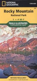
National Geographic Trails Illustrated Map Rocky Mountain National Park
Topographic Map. Rocky Mountain Nationalpark inkl. Arapaho und Roosevelt National Forest, Never Summer Wilderness, Arapaho National Erholungsgebiet. 1 : 50.000
2012. 1 S. 965 x 660 mm
Verlag/Jahr: NATIONAL GEOGRAPHIC MAPS 2012
ISBN: 1-56695-342-1 (1566953421)
Neue ISBN: 978-1-56695-342-9 (9781566953429)
Preis und Lieferzeit: Bitte klicken
Rocky Mountain Nationalpark inkl. Arapaho und Roosevelt National Forest, Never Summer Wilderness, Arapaho National Erholungsgebiet
The Rocky Mountain National Park Trails Illustrated map is the most comprehensive recreational map for Colorado´s Rocky Mountain National Park. Coverage includes Rocky Mountain National Park, Arapaho and Roosevelt National Forest, Never Summer Wilderness, Arapaho National Recreation Area, and the cities of Granby and Estes Park. The map´s shaded relief makes it easy to see the lay-of-the-land, and it has a full UTM grid so you can use it with your GPS. A necessity for exploring in the outdoors, this map is also printed on waterproof, tear-resistant material.