 Neuerscheinungen 2012Stand: 2020-01-07 |
Schnellsuche
ISBN/Stichwort/Autor
|
Herderstraße 10
10625 Berlin
Tel.: 030 315 714 16
Fax 030 315 714 14
info@buchspektrum.de |
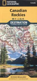
National Geographic Destination Touring Map & Guide Canadian Rockies
1 : 710.000
Rev. ed. 2012. 1 S. 235 mm
Verlag/Jahr: NATIONAL GEOGRAPHIC MAPS 2012
ISBN: 1-59775-513-3 (1597755133)
Neue ISBN: 978-1-59775-513-9 (9781597755139)
Preis und Lieferzeit: Bitte klicken
Perfekte Mischung aus Reiseführer und Karte, Alberta-British Columbia Grenzregion, Jasper, Banff, Yoho, Glacier, and Kootenay Nationalparks, ausführliches Straßennetzwerk inkl. Trans-Canada highway und Icefields Parkway
National Geographic´s Canadian Rockies Destination Map strikes the perfect balance between map and guidebook and is an ideal resource for touring this culturally and geographically unique region. Canada´s share of the Rocky Mountains averages approximately 100 miles across (160 kilometers) and runs from Waterton Lakes National Park on the Alberta-Montana border northwest toward the Yukon territory. DestinationMaps are condensed guide books that are an ideal resource for touring such culturally and geographically unique regions. Printed on waterproof and tear-resistant material.