 Neuerscheinungen 2013Stand: 2020-01-07 |
Schnellsuche
ISBN/Stichwort/Autor
|
Herderstraße 10
10625 Berlin
Tel.: 030 315 714 16
Fax 030 315 714 14
info@buchspektrum.de |

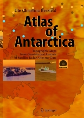
Ute Christina Herzfeld
Atlas of Antarctica
Topographic Maps from Geostatistical Analysis of Satellite Radar Altimeter Data
Softcover reprint of the original 1st ed. 2004. 2013. xv, 365 S. 5 Tabellen. 270 mm
Verlag/Jahr: SPRINGER, BERLIN 2013
ISBN: 3-642-62418-9 (3642624189)
Neue ISBN: 978-3-642-62418-6 (9783642624186)
Preis und Lieferzeit: Bitte klicken
The atlas consists of 136 topographic maps derived from satellite radar altimetry (Geosat and ERS-1 data). Each map is presented together with a description of glaciologic and topographic features. The main section is preceded by an introduction and three up-to-date topics and followed by applications. Applications are in monitoring changes in Antarctic glaciers, ice streams and ice shelves, and in detailed regional studies of outlet glaciers of the inland ice. The reader will also find index maps, an exhaustive list of references on related subjects in glaciology, geodesy, geomathematics, remote sensing, and an index of the Antarctic place names.
From the reviews:
"The Atlas of Antarctica uses radar altimeter data from SEASAT, GEOSAT, ERS-1 and ERS-2 to produce topographic maps ... . Being very widely read, the author is able to reference many aspects ... . Her list of references (not to be confused with a bibliography) includes 245 items-a fair measure of the thoroughness and detail of her research. ... I can thoroughly recommend this atlas as an authoritative source for contouring small and medium-scale maps of the Antarctic ice sheet ... ." (Charles Swithinbank, Geomatics World, Vol. 13 (4), May/June, 2005)
"It presents and analyses the topography of much of a continent based on satellite radar altimetry. Furthermore, the book is exceedingly well written and illustrated. ... It is now appropriate to consider the book as a whole and assess its aspects that may be of general interest. ... It is a landmark volume that mathematical geologists should peruse as well as glaciologists and those interested in the topography of Antarctica." (John W. Harbaugh, Computers & Geosciences, Vol. 31, 2005)
"Herzfeld´s book presents a new series of maps of Antarctica derived from satellite radar altimeter data showing topography of the ice/snow surface. This is therefore a valuable contribution to Antarctic studies. ... This book is an important contribution and groups working in glaciology and remote sensing of polar regions ... ." (Philip T. Leat, Geological Magazine, Vol. 142 (3), 2005)
"The Atlas of Antarctica is the first atlas on the seventh continent to be published in 20 years. It contains 145 accurate topographic and elevation maps ... which are the best of their kind available today. ... is not only intended for use by researchers and students in glaciology, geophysics, remote sensing, cartography, and Antarctic research, but is also informative and enjoyable for any reader interested in the seventh continent. This book is accompanied by a CD-ROM containing all the atlas maps and elevation models." (Lunar and Planetary Information Bulletin, 2005)


